crowdmap
As part of the 8 comprehensive plans I have worked on at JM Goldson LLC, I have developed crowdmaps. These community engagement tools allow municipality residents to share their opinions spatially by adding comments and suggestions directly onto a digital map. For implementation, I use ArcGIS Online, configuring the platform so that users can interact with it easily and effectively.
The biggest challenge in managing these maps lies in the backend, as it requires creating shapefiles to store proposals and properly configuring permissions to prevent user conflicts. Once responses are collected, the data can be analyzed using heat maps to identify the most frequently mentioned locations, as well as keyword analysis to highlight community concerns and priorities.
What is a crowdmap?
A collective map is a public engagement tool that allows residents of a municipality to express their ideas, concerns, and suggestions in a georeferenced manner. Through a digital interface, users can pinpoint areas of interest, describe issues, or propose improvements to the community.
Its value lies in transforming public input into spatial data, making it easier to analyze and visualize for urban planning decision-making. Using techniques such as heat maps and keyword analysis, it is possible to identify patterns and trends in community proposals.
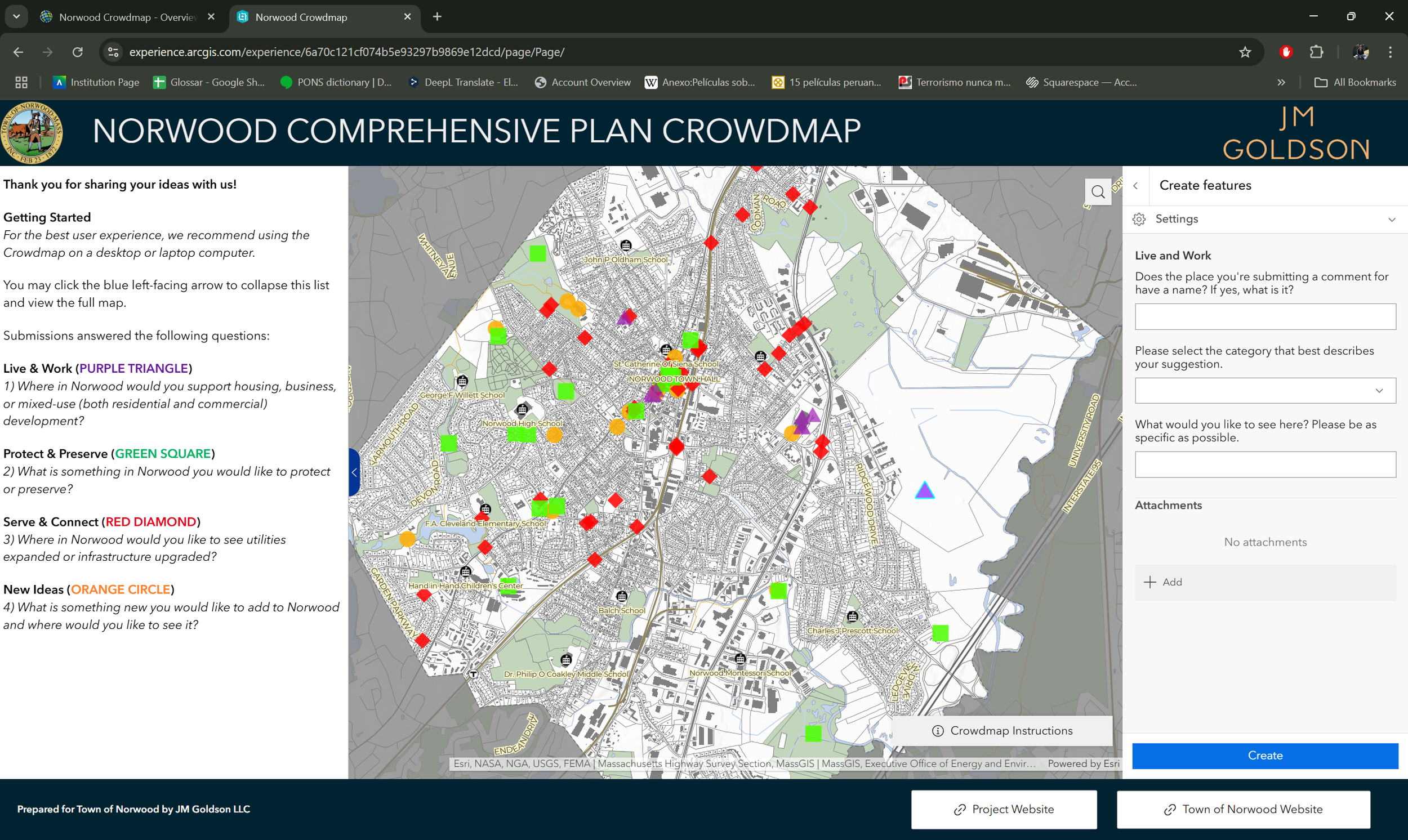
User interface of the crowdmap for the Town of Norwood, MA
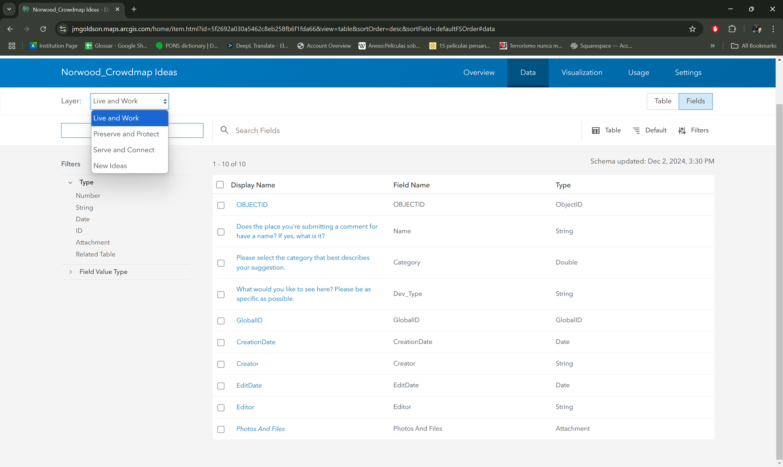
Backend of the shapefile that collects all the residents' proposals
Crowdmap's backend
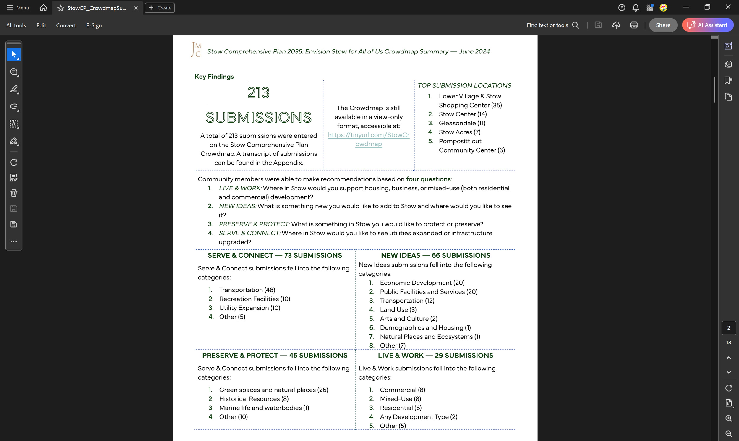
Results processing of the crowdmap for the Town of Stow, MA.
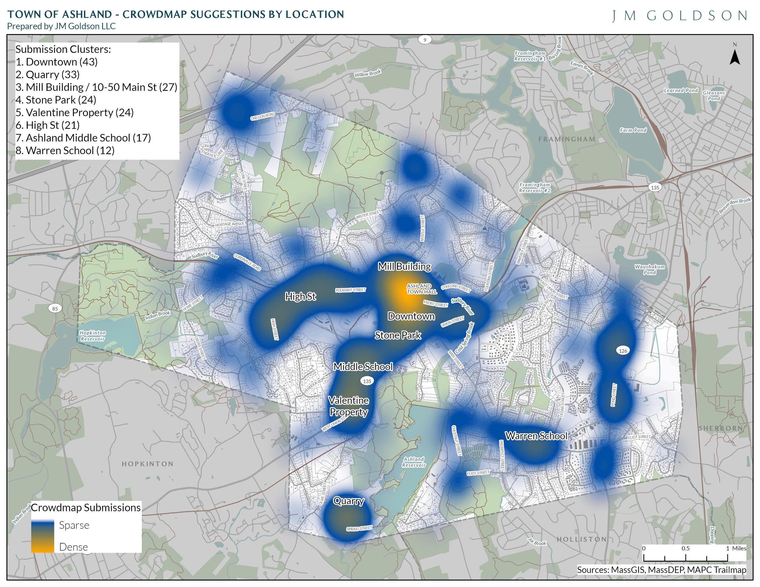
Heat map of the crowdmap results for the Town of Ashland, MA